Riding the Red Lines
A Tour Report
by Kent Peterson
September 7th-8th, 2004
William Least Heat-Moon wrote of
traveling the blue highways, the minor roads on the map. Today I'm
riding still smaller roads and on my map these roads are the tiny red
lines that designate state forest roads. While a map is not the terrain,
it is perhaps the most important fuel for the journey. The thin red line
that becomes a dotted line and winds back on itself tells a story: here
is where the pavement ends, here is where the old road climbs or perhaps
the it is descending? I cannot know these things in the comfortable
confines of civilization. The map pretends to be reality with it's
color-code and tiny symbols: here is a place called Pyramid Peak, here
is where the Pacific Crest trail crosses this tiny road. But in the end
the map must reduce to two dimensions a world that is far more complex
than any piece of paper. The map informs my dreams with this one notion:
I can ride there.
It's 12:15 PM on Tuesday September 7th. A warm sun is shining down on
the small town of Greenwater Washington. I'm eating a Payday candy bar
and sipping on a Powerade in front of the Greenwater General Store. In
my job at the bike shop I work most weekends but now I'm in the midst of
a three day break. I spent yesterday with my lovely wife but today she
is working and I'm on the road. A motorcyclist is also taking a break at
the store and we fall into conversation.
"Where you headed?" I ask.
"Over the pass and then up the Yakima Canyon," he replies.
I know this road well. the canyon section is beautiful and twisty,
winding along the river. It can also be damn windy and I make a comment
to that effect.
"I've never really noticed the wind," the biker replies.
"You notice wind a lot more when you're pedaling," I assure him.
"So where are you headed?" he asks, eying my rig.
"Over old Naches Pass." The biker looks a bit puzzled, so I elaborate.
"Forest Road 70 connects up to 19 via some little dirt roads up there,"
I say waving my hand in a vaguely easterly direction.
The biker is intrigued and we talk about the little I know of the
route. His motorcycle today is some sort of pavement-only street machine
but he mentions that he has a DualSport at home. "Do you think that
could make it over on that?" he queries.
"I think so," I reply, "I've heard this is an old stage coach run and
I've read about four-wheel-drive trucks and ATVs going over it. This is
my first time going up there, but I think a knobby-tired bike should be
fine."
The biker agrees that his DualSport could make it over and then we talk
more about our planned rides: he's out for a day ride, while this is a
two day trip for me. He approves of my compact gear, wishes me luck on
my trip, fires up his bike and then he's gone. I finish the last of my
Powerade, throw a leg over my bike and head east slowly. It's a good day
to ride.
At 12:38 PM, I turn off Highway 410 and onto Forest Road 70, I'm 79
kilometers from home now but this really feels like the start of the
ride. My maps are a couple of pages photocopied from a benchmark Roads
and Recreation Atlas, but the thin lines do little to prepare me for the
beauty of this road. Forest Road 70 winds east and up into the Cascade
Mountains.

Forest Road 70 works its way up along the channel of the Greenwater
passing by tiny riverside campsites and then climbs upward into the
mountains. The pavement is smooth and on this weekday there is
virtually no traffic. The climbing is not relentless, in places the road
drops back down, following the contours of the land. But there is far
more up than down and in places it's rather steep. I chug along,
spinning the Monocog's 32*16 gear.
Over the years I've realized that I have no real interest in luxury,
I'm more interested in learning what I can do with minimal equipment. My
bicycle today is a Redline Monocog, a basic steel bicycle with a single
gear. Certainly there are faster bikes, but I don't need to be fast. I
am persistent.
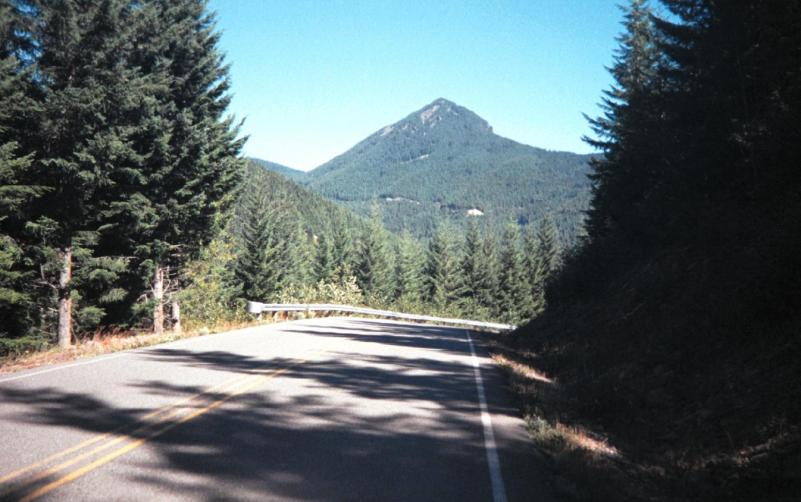
My map tells me of a 5700' mountain called Pyramid Peak and I suspect
it is the mountain I see in the distance. For much of the time, the
views are blocked by trees but occasionally vistas open up and I can see
large chunks of wild land.
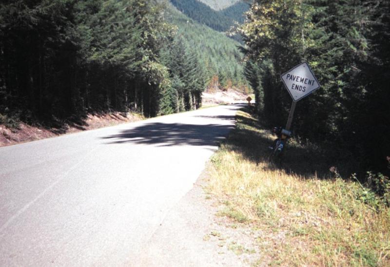
At 1:46 PM, I reach the end of the pavement. It has taken me more than
an hour to cover 9 kilometers but I know I've already climbed up quite a
ways.
It's 2:29 PM now. Back on the paved road, I'd thought that I was
climbing. Twelve percent grades are steep, but what I'm going up now is
steeper. I'm 100 kilometers from home now and it's steep enough that I
wind up stopping to rest every 500 meters or so. This is not a conscious
schedule, it's the rhythm dictated by the land. I ride until I think
"hey, I should take a break" or "hey, I should stop for a quick snack"
and when I look down at the cyclometer I see that I've only gone half a
kilometer since my last break. But this is the right rhythm for this
land. I chug along then stop and then chug along again. And I am gaining
ground.
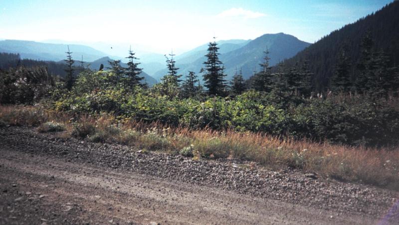
My maps are vague on the details here and I wind up following Forest
Road 70 too far. It ultimately ends at a trail to small to be on the map
and I know I must have gone wrong. I backtrack to a fork in the road and
follow the other route. This road goes alarmingly downward before
deteriorating into untrailed wilderness. My wrist compass tells me this
can't be right and I backtrack again.
Several kilometers back, I'm at yet another fork in the road. The route
to the left is clearly not Forest Road 70 but it looks as broad as 70
and seems to climb in a promising direction. As I turn onto this road an
elk crosses in front of me. I take this as a good omen and continue
upward.

The road is in fact the right road. It goes up and up and eventually
crosses the pacific crest. My map had told of a gate followed by two
switchbacks and then a second gate and I rejoice at 4:45 PM when I find
the first gate. It turns out that the first gate is pretty much at the
summit and the switchbacks are long, swooping descents down the other
side. After hours of climbing, the switchbacks are a definite change of
pace. What would be climbed very slowly is descended very quickly. As I
pilot the Monocog though the swooping turns I have the quick thought
that there is no way I would climb this road from this eastern side.
But in the next instant I realize that of course I could climb this,
and what I'm swooping down is no worse than what I climbed up on the
western side. It's not a question of strength or gears, I have a single
gear and not much strength but what I have is enough.
After the long pair of switchbacks I come up to the second gate. As I
roll up to the gate I hear something mechanical groaning, grinding and
crunching civilized sound of that can only be made by largish piece of
rolling machinery. Looking in my helmet mirror, I see a truck winding
it's way toward me, slowly descending the switchbacks. I wait just past
the gate and wave at the truck's occupants as they rumble dustily on by.
The truck is not what I'd expect. I'd seen a few four wheel drive
pickups and SUVs earlier on the road but as I've gotten into the higher
country, I've pretty much been alone. This truck is far bigger than an
SUV and my first thought is that it was a logging truck but in this
case my first thought is mistaken.
The truck contains two men in the cab but in the back are many thousand
passengers, snug in their hives. The truck is hauling bees. The writing
on the side of the truck tells me it belongs to a honey farm based in
Yakima.
At first I'm puzzled as to why anyone would transport their bees over
this old pass but then I realize that the ranch must have the bees
spend the summer up here in the mountains. Wild flower and fireweed
pollen are prized and now it's harvest time. In a few weeks the snows
will come and close this pass for the winter. It's time for the bees to
move to the lower meadows.
I continue downward an at 5:27 PM this dirt road joins up with pavement
as I turn left onto Forest Road 19. 19 is a beautiful strip of pavement
rolling south and east and down for miles. Along the side of the road
there are dozens of inviting looking off-road-vehicle trails that look
like they'd be terrific for mountain biking. Some other day I'll have
to come back here and do some more exploring.
I'd started my trip with three bottles of water, two large bottles on
the bike and a smaller bottle in my backpack but I'm running on empty
now. There were many mountain streams and if I'd needed to I could've
stopped to purify water en route but I'd figured my rations correctly.
I figure I can stop at one of the campgrounds along the road and fuel
up.
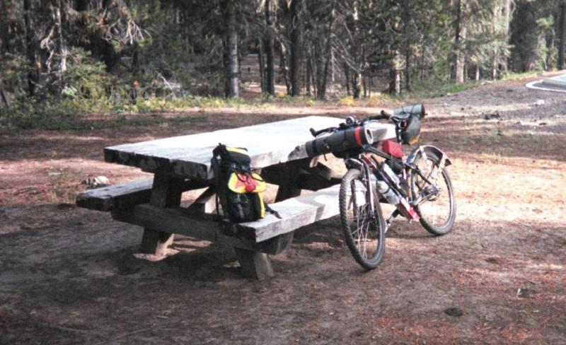
At 6:25 PM, I stop at Kaner Flat Campground to fill my water bottles.
The water from the pump is clear and cold and I take a couple of photos
of my bike, myself and my gear. the campground is a bit more civilized
than I prefer and it seems wasteful to me to spend $10 or $15 dollars
to camp on public land, so I roll onward.

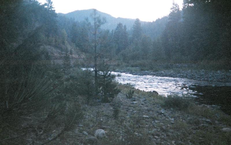
At 6:45 PM, I turn left onto the Hwy 410. The Bumping and Naches Rivers
converge here and just off the road I find a nice, quiet spot to camp.
I pitch my tarp, lay out my gear, eat a simple supper and enjoy a quiet
evening by the river. Before I settle in for the night, I pack all my
food in a bag and hoist it into the high branches of a handy tree.

I wake at 6:45 AM. The morning is clear and crisp but not too cold. I
eat breakfast, pack up the bike and I'm back on the road at 7:33 AM.
It must be a good year for chipmunks because I see hundreds of them on
the climb up to Chinook Pass. It seems like every ten meters or so I
hear one let out an excited squeak and scurry off into to forest. If
the chipmunks would just sit there, I might not notice them as much but
they all seem to like to squeak and run.
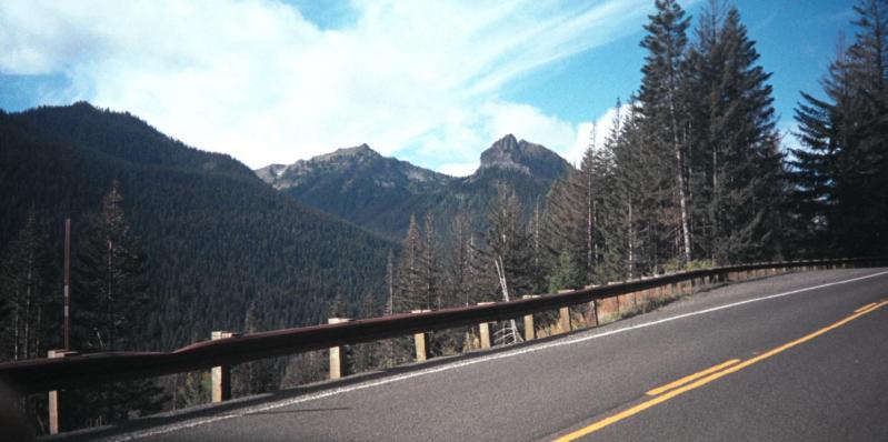
The climb to Chinook is always beautiful and I stop a bit en route to
take pictures, rest and have a snack.

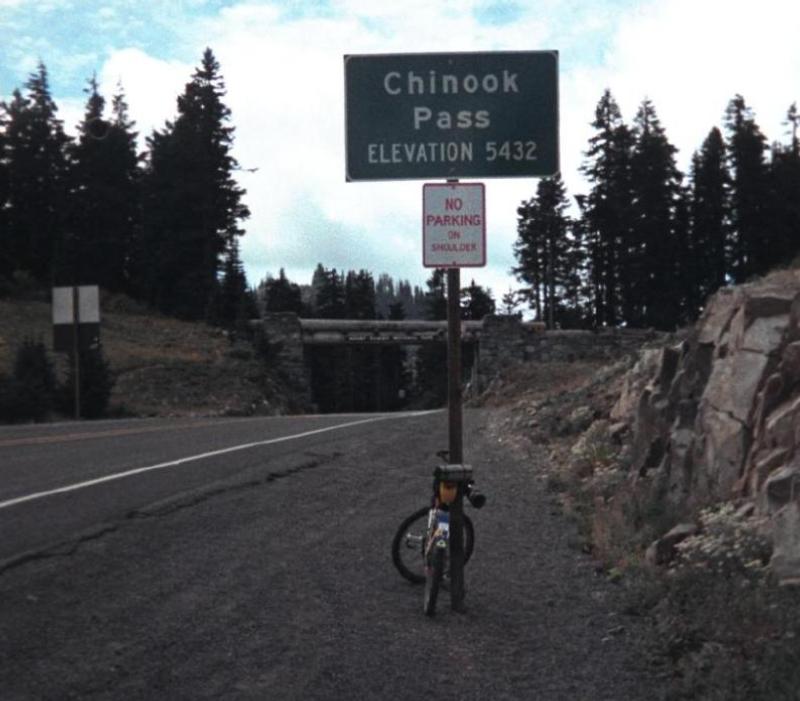
At 10:57 AM, I'm at the Chinook summit. I layer on my warm clothes for
the descent.
I'd figure that I'd just roll down quickly but just past the summit the
lake is just too picture postcard perfect. I have to stop and take a
picture.


The switchbacked descent off Chinook is fun and at 12:55 PM, I'm back
in Greenwater. I celebrate my return to civilization with a latte at
the Wapiti Woolies store. At 3:55 PM, I roll into a rainstorm near Lake
Retreat but I'm no stranger to rain. At 5:03 PM, I'm back home.
The total trip was a very relaxing 307 kilometers spread over a couple
of days. I figure I logged a few extra kilometers in a few wrong turns
up in the mountains. Now that I know the way, I figure it's about a 300
kilometer loop. Kicking things up a notch, starting earlier in the day
and running later, it's a randonneurs day ride. But not for this year,
the pass will close soon for the winter and most of my rando pals are
already starting to go dormant. But next year, I think I'll be able to
talk at least one or two of my buddies into joining me on this trip.